AG Digitale Gesundheitsgeographien
Wie gestalten und beeinflussen raumbezogene (digitale) Daten regionale, lokale und diskursive Wissensproduktion? Wie werden insbesondere Krisendiskurse durch raumbezogene (digitale) Daten (re-)produziert? – z.B. Klimawandel, Gesundheitsrisiken, Zwischenmenschliche Gewalt, Naturkatastrophen Wie fördern Routinen und Praktiken des Umgehens mit Umwelt mentale Resilienz und soziale Gesundheit? Wie beeinflusst die Anwendung von GIS in der Praxis den Gegenstand und die Betrachtungsweise räumlicher Analysen?
Diese Schlüsselfragen leiten unsere Forschung und werden in den unten aufgeführten Projekten genauer verfolgt. |

Raphaela Edler
- E-Mail: raphaela.edler@fau.de


Andreas Neuner
- E-Mail: andreas.neuner@fau.de

Lama Ranjous
- E-Mail: lama.ranjous@fau.de
Lama Ranjous is a doctoral candidate and research associate affiliated with the Institute of Political Science at FAU Erlangen-Nurnberg. She holds a Bachelor's degree in Political Science from Damascus University and a Master's degree in International Policy and Development from the Middlebury Institute of International Studies. Her research focuses on the innovative use of digital technologies, especially in the fields of human rights and humanitarian efforts. She has a keen interest in understanding how digital technology transforms documentation practices in conflict-affected areas.


The rapid nascence of data availability, powerful algorithms, and quantitative methodology are necessitating novel conceptualisations of „digital“, serving both as an applied means of constructing information and as an arena for critical inquiry into emergent modes of representation. With a broad focus on the interplays between human health and social/built/natural environments, the Digital Health Geographies Research Group explores the confluence of applied machine learning and the analysis of situated, community-scale sociocultural practice through empirical study.
Die Auswirkungen des Klimawandels in Bayern bedeuten in der Zukunft eine Tendenz zu länger anhaltenden Hitzephasen im Sommer mit teils deutlich über 40°C. Dadurch steht Kulturlandschaft in ihrer resilienzstiftenden und gesundheitsfördernden Wirkung für die Bevölkerung vor großen Herausforderungen. Es geht dabei nicht nur um den Verlust einer vertrauten ästhetischen Qualität, sondern um konkrete Einschränkungen als Erholungsort, Ort sozialer Teilhabe und Raum für körperliche Aktivität und Sport. Dies betrifft die Nutzbarkeit des heimischen Balkons genauso wie sommerliche Freiluftveranstaltungen oder die wöchentliche Walking-Gruppe im nahen Wald. Die Folgen des Klimawandels treffen dabei nochmals verstärkt vulnerable Bevölkerungsgruppen, die ohnehin nur eingeschränkten Zugang zu gesundheitsfördernden Kulturlandschaftselementen haben.
Weitere Informationen zum Projekt
Im vom BMBF finanzierten GeoDataRights Projekt werden die Möglichkeiten einer (geo-)datengestützten Dokumentation von Zerstörungen und militärischen Aneignungen ziviler Bildungseinrichtungen in den Kriegen in Syrien untersucht. Dabei soll exemplarisch die Erschließung, Bearbeitung und Interpretation georeferenzierter Daten insbesondere aus der satellitengestützten Fernerkundung aber auch aus weiteren Quellen (bspw. georeferenzierbare Text-, Bild- und Video-Nachrichten aus soziale Medien, Projekte der Web 2.0-Kartographie) für die Menschenrechtsforschung herausgearbeitet werden.
Brazil is known worldwide for its vibrant cultural diversity and beautiful landscapes. However, increasing awareness of deeply embedded social issues such as social inequality, poverty, and violence underscores the need for more nuanced understandings of their interrelations with space and place. VIBRANCE is a collaborative study bringing together researchers from Brazil, Germany, and Canada to develop and implement innovative interdisciplinary approaches to studying space, place, and violence. By using advanced quantitative techniques and situated qualitative inquiry, VIBRANCE assesses various domains of social and spatial risk factors of violence at multiple scales across the country, seeking to advance understandings of the complex geographies of violence and to identify policies and programmes to reduce the burden of violence in Brazilian communities.
External Partners:
- Dr. Kevan Guilherme Nóbrega Barbosa, Centro Universitário CESMAC, Macieó, Brazil.
Theses:
- Anton Leutner, BA Thesis: Spatialities of Violence: Analysis socioeconomic patterns of gun violence in Rio de Janeiro and Recife, Brazil
- Antonia Bauer, BA Thesis: Instrumentalization of space through violence
- Julian Hofmann, BA Thesis: Gemeinwohlökonomie im brasilianischen Kontexten
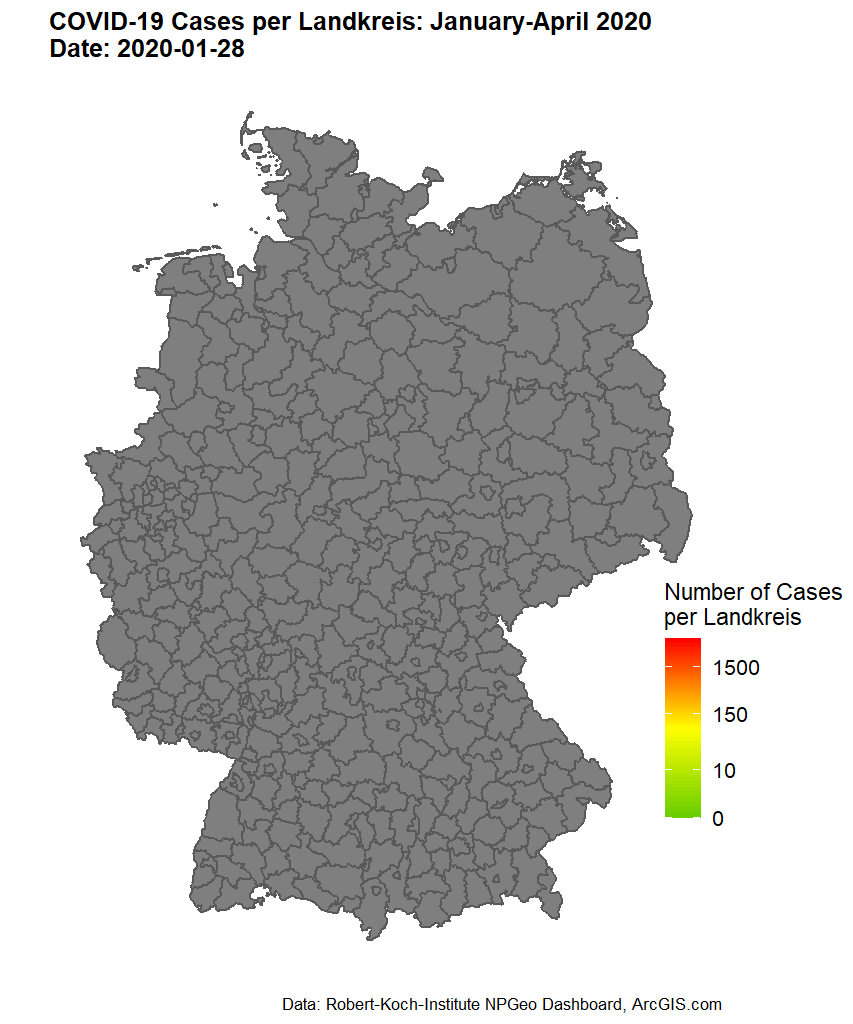
Using COVID-19 as an example, the Digital Health Geographies research group uses automated knowledge mining methods to investigate, on the basis of different types of text, (1) which spatial-cognitive strategies are used to consistently locate crises outside one’s living environment, (2) which events modify these narratives over time, and (3) how newly emerging arguments discursively re-bind these events. The aim of the study is to alleviate the socioeconomic consequences of crises by revealing the suspensive character of certain narratives for necessary political decision-making processes.
Schon längst existieren Datenbanken, die Isotopenverhältnisse im Niederschlag aufzeichnen. Das Projekt IsoGW unter Federführung des GeoZentrums Nordbayern der FAU wird ein solches digitales Verzeichnis jetzt auch für das Grundwasser in Deutschland erstellen. Die Daten des Vorhabens werden der Öffentlichkeit als interaktive Karte kostenlos zur Verfügung stehen. Mit dieser Datenbank lassen sich die Verhältnisse im Grundwasser selbst und Einflüsse von außen erheblich einfacher als bisher beobachten.
Wie nachhaltig sind zum Beispiel Brunnen, die das Nass oft für viele Menschen und etliche Unternehmen nach oben holen? Halten sich die Mengen von neu gebildetem und entnommenem Wasser die Waage oder wird vielleicht mehr Wasser an die Oberfläche gepumpt als gleichzeitig neu entsteht? Zapft der Brunnen also vielleicht Vorräte von uraltem Wasser an, das sich vor vielen Jahrtausenden gebildet hat und das viel langsamer ersetzt als entnommen wird? Wie verändert der Klimawandel die Menge des Wassers im Untergrund?
Forschungsgruppen, Behörden und Wirtschaftsunternehmen sollen Antworten auf diese und weitere Fragen mit Hilfe der von IsoGW erstellten Datenbank schneller und einfacher als heute beantworten können. Das Bundesministerium für Bildung und Forschung (BMBF) fördert das Verbundprojekt „IsoGW“ zur Fördermaßnahme „LURCH“ im Rahmen des Bundesprogramms „Wasser: N“. Wasser: N ist Teil der BMBF-Strategie „Forschung für Nachhaltigkeit” (FONA).
Open Worlds, Digital Landscapes: digital inscriptions of cultural mythologies in playable open worlds and built environments.
In the field of Place Research, visual spaces, both real-world and artificial, provide a stage for shared social practice. There exist different forms of visual spaces, ranging from complete virtual worlds over augmented reality to geoservices, which add digital information on site.
Individual practice is bound to the participant’s specific experiences and cultural context. As it can be revealed by the metaphor of game and play, we explore how these aspects are represented, expressed, and enacted in different game environments. Derived questions cover: How is space used as an element within the game to create a flow state, which binds the player to the game?
Theses:
- Daniel Sonnenwald, BA Thesis: „A GALAXY FAR FAR AWAY… “: Space Syntax and Critical Theory as a Framework to investigate the Spatiality in the Medium of Video Games.
Drawing on a geographical interpretation of Star Wars Jedi: Fallen Order, the author investigates the functionality of space in video games. How is space used as an element within the game to create a flow state that keeps the player engaged in the game? How is affordance created and communicated through digital architecture? How is the spatial Design understood as part of the games narrative and how does it incorporate political and social layers? In the eyes of the author, a combination of approaches from critical theory and the analysis of space syntax is the means of choice to investigate these questions.
- Lukas Suk, BA Thesis: Roles of Landscape in Red Dead Redemption 2
In this bachelor thesis, the author analyses video games through a landscapes lens, focussing on Red Dead Redemption 2, combining theoretically supported geographical perspectives with the conceptualization of game development and game design on the concept of landscape. Using an analytical methodology, the author aims to discuss the purposes of landscape in Red Dead Redemption 2, considering the functions of individualization, immersion, and value mediation and the means by which these functions can be implemented.
- Bryan Maland, BA Thesis: Geographische Analyse des Videospiels Red Dead Redemption 2 mithilfe der Prospect Refuge Theory
Video games have long since ceased to be purely entertainment media. This thesis shows that video games are receiving more and more attention in a global context and should therefore take up an increasingly larger part in the research context. The goal of this work is to decode the semiotic sign systems of video games, which are consciously or unconsciously inserted into the game by every game designer, using Prospect Refuge Theory. As an example for this analysis, the game Red Dead Redemption 2 from Rockstar Games was chosen. In this game you act as Arthur Morgan, an outlaw in the Wild West of America in 1899. The picturesque landscape and the survival game principle leave a lot of room for interpretation of Appelton’s theory. The entire space of the Open World is divided into smaller individual rooms in order to make up Prospect, Refuge, and Hazard Spaces. These spaces can then be viewed from different perspectives. In the game it would be either the view of Arthur Morgan or that of a First Nations (North American indigenous) person. The application of the theory, i.e. the identification of the individual spaces, is only possible through the imbued realism of spaces that Rockstar has added to the game. Ultimately, it must be recognized that video games today, due to their their semiotic effects, set a valuable example that can have a polarizing effect on players.
This project seeks to disentangle the complex relationships between socioeconomic status, the built/natural environment, and chronic diseases, specifically focussing on cardiovascular disease and diabetes mellitus risk factors. Using epidemiological techniques and machine learning, we develop socioeconomic and environmental indices to estimate the spatial component of CVD risk. This project is being conducted as part of the Prospective Urban and Rural Epidemiology (PURE) Study.
External Partners:
- Prof. Scott A. Lear, Providence Health, Vancouver, Canada
In what ways does greenspace influence human health?
Urban greenspaces such as parks, trees, gardens, or green roofs may have a positive effect on physical and mental health. However, the pathways concerning how greenspaces promote health are often complex. For example, higher availability of vegetation contributes to improved air quality and reduces the effects of urban heat islands, access to public parks can provide opportunities for exercise and community building, and higher visible greenness in daily life may reduce stress and anxiety.
By 2030, 60% of the worlds population will be living in urban environments and even though greenspaces have the potential to buffer the adverse health effects of urban living, studies suggest that this potential often remains underutilised. It is thus important to understand the different types of greenspace exposure (e.g. Accessibility, Availability, and Visibility of Greenspace) and their underlying pathways to assist decision makers and urban designers in their efforts to build healthy and sustainable cities.
In this project we investigate these complex relationships and effects on human health by building spatial algorithms to improve Greenspace Exposure Modeling.
GVI: Greenness Visibility Index
Sebastian Brinkmann provides a tool for 3D modelling of greenness visibility, as seen through the eyes of a pedestrian. Using Digital Elevation Models and Land Cover datasets, the GVI enables detailed analysis of the associations between urban greenspace and mental health. The GVI R package is available for free, non-commercial use at github.com/STBrinkmann/GVI.
- Marika Cordes, MA Thesis: Global South-North Innovation Mobilities in Medical Diagnostic Technologies – A Case Study of Rats for Tuberculosis Detection.
- Lasse Harkort, BA Thesis: Analysis of Collisions with Cyclist Participation by Regional Typology in Germany
2025
- , , :
Editorial - Digitale Geographiedidaktik außerschulischer Lernorte
In: GW-Unterricht : eine Zeitschrift des "Forums GW - Verein für Geographie und Wirtschaftserziehung" 1 (2025), S. 1-2
ISSN: 2077-1517
DOI: 10.1553/gw-unterricht176s1
BibTeX: Download - , , , , :
Applied Digital Humanities: Calling for a more engaged Digital Humanities
Digital Humanities im deutschsprachigen Raum (DHd) (Universität Bielefeld, 3. März 2025 - 7. März 2025)
DOI: 10.5281/zenodo.14942990
BibTeX: Download - , , :
Der GeoExplorer: ein Werkzeug für die Gestaltung ortsbezogener digitaler Lernerfahrungen
In: GW-Unterricht : eine Zeitschrift des "Forums GW - Verein für Geographie und Wirtschaftserziehung" 1 (2025), S. 78-84
ISSN: 2077-1517
DOI: 10.1553/gw-unterricht176s78
BibTeX: Download - , , , , , , :
How to assess neighborhood resilience in the context of public health emergencies? Insights from an indicator assessment in Berlin-Neukölln, Germany
In: Cities & Health (2025)
ISSN: 2374-8834
DOI: 10.1080/23748834.2024.2440980
BibTeX: Download
2024
- , (Hrsg.):
Geographical Research in the Digital Humanities. Spatial Concepts, Approaches and Methods
Bielefeld: 2024
(Digital Humanities Research)
ISBN: 978-3-8394-6918-7
DOI: 10.14361/9783839469187
BibTeX: Download - , :
Spatial concepts, approaches and methods for digital humanities-an introduction to the book
Bielefeld University, 2024
ISBN: 9783839469187
BibTeX: Download - , :
Spatial Concepts, Approaches and Methods for Digital Humanities – An Introduction to the Book
In: Finn Dammann, Dominik Kremer (Hrsg.): Geographical Research in the Digital Humanities. Spatial Concepts, Approaches and Methods, Bielefeld: Bielefeld University Press, 2024, S. 7-12 (Digital Humanities Research, Bd.8)
ISBN: 978-3-8376-6918-3
Open Access: https://www.transcript-verlag.de/media/pdf/22/3a/2a/oa9783839469187xd0q4zVqzoIrR.pdf
BibTeX: Download - , :
Konzepträume: Ein Vorschlag zur besseren Abstimmung von Theoriehintergrund und digitalen Datenanalysen
Digital Humanities im deutschsprachigen Raum (Passau, 26. Februar 2024 - 1. März 2024)
In: Joëllle Weis, Estelle Bunout, Thomas Haider, Patrick Helling (Hrsg.): Book of Abstracts 2024
DOI: 10.5281/zenodo.10698442
BibTeX: Download - , , , , , :
Rendering Cliché? Visual Consumption of Video Games as Virtual-Space Leisure Activities
In: Michael Morawski, Sebastian Wolff-Seidel (Hrsg.): Gaming and Geography. A Multi-perspective Approach to Understanding the Impacts on Geography (Education), Cham: Springer, 2024, S. 137-158 (Key Challenges in Geography)
ISBN: 978-3-031-42259-1
DOI: 10.1007/978-3-031-42260-7_7
BibTeX: Download - , , :
Effiziente Zusammenarbeit in den Digital Humanities. Ein Erfahrungsbericht aus drei Jahren Anwendung von Scrum in Forschungskontexten
In: Fabian Cremer, Swantje Dogunke, Anna Maria Neubert, Thorsten Wübbena (Hrsg.): Projektmanagement und Digital Humanities. Zur klugen Gestaltung der Zusammenarbeit, Bielefeld: Bielefeld University Press, 2024, S. 153-184 (Digital Humanities Research, Bd.9)
ISBN: 9783837669671
DOI: 10.14361/9783839469675-006
BibTeX: Download - , :
Placing wellbeing: Distant reading approaches for exploratory placial data analysis
In: Finn Dammann, Dominik Kremer (Hrsg.): Geographical Research in the Digital Humanities. Spatial Concepts, Approaches and Methods, Bielefeld: Bielefeld University Press, 2024, S. 135-150 (Digital Humanities Research, Bd.8)
ISBN: 9783839469187
BibTeX: Download - , , , , , :
Räumliche Erreichbarkeit von Gedächtnisambulanzen – Eine geographische Analyse im Rahmen von digiDEM Bayern
In: Gesundheitswesen 86 (2024), S. 263-273
ISSN: 0941-3790
DOI: 10.1055/a-2233-6168
BibTeX: Download - :
Petrichor and positionality: Occasion for a situated spatial epidemiology in the digital humanities
In: Finn Dammann, Dominik Kremer (Hrsg.): Geographical Research in the Digital Humanities. Spatial Concepts, Approaches and Methods, Bielefeld: Bielefeld University Press, 2024, S. 63-79 (Digital Humanities Research, Bd.8)
ISBN: 9783839469187
DOI: 10.14361/9783839469187-005
BibTeX: Download
2023
- , , , :
The utility of street view imagery in environmental audits for runnability
In: Applied Geography 162 (2023), Art.Nr.: 103167
ISSN: 0143-6228
DOI: 10.1016/j.apgeog.2023.103167
URL: https://www.sciencedirect.com/science/article/abs/pii/S0143622823002989
BibTeX: Download - , , :
Spatiotemporal Patterns of Cyclist Collisions in Germany: Variations in Frequency, Severity of Injury, and Type of Collision in 2019
In: Applied Spatial Analysis and Policy (2023)
ISSN: 1874-463X
DOI: 10.1007/s12061-022-09476-w
BibTeX: Download - , , , , , :
Tracing Individual Experiences of Everyday Greenness: Initial Results from the SpaceLog Mobile App
In: GI_Forum 11 (2023), S. 47-58
ISSN: 2308-1708
DOI: 10.1553/giscience2023_02_s47
BibTeX: Download - , :
The Nuremberg Stations of the Cross. Enriching On-Site Experiences of a Historical Pathway by the “FAU GeoExplorer” App.
In: Münster S., Pattee A., Kröber C., Niebling F. (Hrsg.): Research and Education in Urban History in the Age of Digital Libraries. UHDL 2023, Cham: Springer, 2023, S. 207-219 (Communications in Computer and Information Science, Bd.1853)
DOI: 10.1007/978-3-031-38871-2_12
URL: https://link.springer.com/chapter/10.1007/978-3-031-38871-2_12
BibTeX: Download - , :
Co-creation of Place-Based Content for Field Trips and Public Trails by Geo-Content Management
Fourth International Symposium on Platial Information Science (PLATIAL’23) (Dortmund, 19. September 2023 - 21. September 2023)
In: René Westerholt, Franz-Benjamin Mocnik (Hrsg.): Transforming Places. Proceedings of the 4th International Symposium on Platial Information Science (PLATIAL’23) 2023
DOI: 10.5281/zenodo.8286273
BibTeX: Download
2022
- , , , :
COVID-19 incidence in border regions: spatiotemporal patterns and border control measures
In: Public Health 202 (2022), S. 80-83
ISSN: 0033-3506
DOI: 10.1016/j.puhe.2021.11.006
BibTeX: Download - :
WebGIS meets E-Learning. Werkzeuge für digital unterstützte geographische Exkursionen.
In: Leena Bröll, Julius Erdmann, Björn Egbert (Hrsg.): Bildung auf Distanz: (Medien-)Technologie, Politik und Lebenswelten in aktuellen Lernprozessen, Berlin: trafo Wissenschaftsverlag, 2022, S. 43-54 (e-culture, Bd.29)
BibTeX: Download - , :
Reasoning COVID-19: the use of spatial metaphor in times of a crisis
In: Humanities and Social Sciences Communications 9 (2022), Art.Nr.: 265
ISSN: 2662-9992
DOI: 10.1057/s41599-022-01264-8
BibTeX: Download - , , :
Explorative spatial analysis of the function of landscape in video games.
In: Burghardt M, Dieckmann L, Steyer T, Trilcke P, Walkowski N, Weis J, Wuttke U (Hrsg.): Fabrikation von Erkenntnis – Experimente in den Digital Humanities., Wolfenbüttel: Zeitschrift für digitale Geisteswissenschaften und Melusina Press, 2022 (Zeitschrift für digitale Geisteswissenschaften / Sonderbände, Bd.5)
DOI: 10.17175/sb005_009
BibTeX: Download - , :
Geodaten quantitativ, aber kritisch analysieren – die Methode der explorativen räumlichen Datenanalyse am Beispiel von COVID-19 in Brasilien
In: Dammann F, Michel B (Hrsg.): Handbuch Kritisches Kartieren, Bielefeld: transcript Verlag, 2022, S. 307-324 (Sozial- und Kulturgeographie, Bd.51)
DOI: 10.1515/9783839459584-021
BibTeX: Download - , , :
Placial-Discursive Topologies of Violence: Volunteered Geographic Information and the Reproduction of Violent Places in Recife, Brazil
In: ISPRS International Journal of Geo-Information 11 (2022), Art.Nr.: 500
ISSN: 2220-9964
DOI: 10.3390/ijgi11100500
BibTeX: Download - , , :
Implementing urban canopy height derived from a TanDEM-X-DEM: An expert survey and case study
In: Isprs Journal of Photogrammetry and Remote Sensing 187 (2022), S. 345-361
ISSN: 0924-2716
DOI: 10.1016/j.isprsjprs.2022.02.015
BibTeX: Download - , , :
Experiences of place-bound sociality amidst the COVID-19 pandemic: A qualitative analysis of environment-related coping strategies
In: Erdkunde 76 (2022)
ISSN: 0014-0015
DOI: 10.3112/erdkunde.2022.03.02
BibTeX: Download - , , , , , , , , , :
Neighborhood Greenspace and Socioeconomic Risk are Associated with Diabetes Risk at the Sub-neighborhood Scale: Results from the Prospective Urban and Rural Epidemiology (PURE) Study
In: Journal of Urban Health-Bulletin of the New York Academy of Medicine (2022)
ISSN: 1099-3460
DOI: 10.1007/s11524-022-00630-w
BibTeX: Download - , , :
Modelling eye-level visibility of urban green space: Optimising city-wide point-based viewshed computations through prototyping
25th AGILE Conference on Geographic Information Science “Artificial Intelligence in the service of Geospatial Technologies” (Vilnius, 14. Juni 2022 - 17. Juni 2022)
In: Parseliunas E, Mansourian A, Partsinevelos P, Suziedelyte-Visockiene J (Hrsg.): 25th AGILE Conference on Geographic Information Science “Artificial Intelligence in the service of Geospatial Technologies” 2022
DOI: 10.5194/agile-giss-3-27-2022
URL: https://agile-giss.copernicus.org/articles/3/27/2022/
BibTeX: Download
2021
- , , , , :
Key Challenges for Land Use Planning and Its Environmental Assessments in the Abuja City-Region, Nigeria
In: Land 10 (2021), Art.Nr.: 443
ISSN: 2073-445X
DOI: 10.3390/land10050443
URL: https://www.mdpi.com/2073-445X/10/5/443
BibTeX: Download - , , , , , :
Spatial-temporal patterns of homicide in socioeconomically deprived settings: violence in Alagoas, Brazil, 2006‒2015
In: Global Health Action 14 (2021), Art.Nr.: 1952752
ISSN: 1654-9880
DOI: 10.1080/16549716.2021.1952752
BibTeX: Download - , , , :
Armed conflict and cross-border asymmetries in urban development: A contextualized spatial analysis of Goma, Democratic Republic of the Congo and Gisenyi, Rwanda
In: Land Use Policy 109 (2021), Art.Nr.: 105711
ISSN: 0264-8377
DOI: 10.1016/j.landusepol.2021.105711
URL: https://www.sciencedirect.com/science/article/pii/S0264837721004348
BibTeX: Download
2020
- , , , , :
Simulating Urban Land Expansion in the Context of Land Use Planning in the Abuja City-Region, Nigeria
In: Geo Journal (2020)
ISSN: 0343-2521
DOI: 10.1007/s10708-020-10317-x
BibTeX: Download - , , , , :
Perceived differences in the (re)production of environmental deprivation between sub-populations: A study combining citizens’ perceptions with remote-sensed and administrative data
In: Building and Environment 174 (2020), Art.Nr.: 106769
ISSN: 0360-1323
DOI: 10.1016/j.buildenv.2020.106769
BibTeX: Download - , , , , , :
A multimethod approach for county-scale geospatial analysis of emerging infectious diseases: a cross-sectional case study of COVID-19 incidence in Germany
In: International Journal of Health Geographics 19 (2020), Art.Nr.: 32
ISSN: 1476-072X
DOI: 10.1186/s12942-020-00225-1
BibTeX: Download - , , , , :
Qualitative field observation of pedestrian injury hotspots: A mixed-methods approach for developing built- and socioeconomic-environmental risk signatures
In: International Journal of Environmental Research and Public Health 17 (2020), Art.Nr.: 2066
ISSN: 1661-7827
DOI: 10.3390/ijerph17062066
BibTeX: Download - , , , , , , , , :
Towards a Situated Spatial Epidemiology of Violence: A Placially-Informed Geospatial Analysis of Homicide in Alagoas, Brazil
In: International Journal of Environmental Research and Public Health 17 (2020)
ISSN: 1660-4601
DOI: 10.3390/ijerph17249283
URL: https://www.mdpi.com/1660-4601/17/24/9283
BibTeX: Download - , , , :
GIS-based multicriteria evaluation for earthquake response: a case study of expert opinion in Vancouver, Canada
In: Natural Hazards (2020)
ISSN: 0921-030X
DOI: 10.1007/s11069-020-04390-1
BibTeX: Download - , , , , , :
Cancer resection rates, socioeconomic deprivation, and geographical access to surgery among urban, suburban, and rural populations across Canada
In: PLoS ONE 15 (2020), Art.Nr.: e0240444
ISSN: 1932-6203
DOI: 10.1371/journal.pone.0240444
BibTeX: Download - , , , , :
Multimorbidity and Socioeconomic Deprivation among Older Adults: A Cross-sectional Analysis in Five Canadian Cities Using the CLSA
In: Journal of Aging and Environment (2020)
ISSN: 2689-2618
DOI: 10.1080/26892618.2020.1734138
BibTeX: Download
2019
- , , , , , :
Epidemiological and spatial characteristics of interpersonal physical violence in a Brazilian city: A comparative study of violent injury hotspots in familial versus non-familial settings, 2012-2014
In: PLoS ONE 14 (2019), S. 1-19
ISSN: 1932-6203
DOI: 10.1371/journal.pone.0208304
BibTeX: Download - , , , , :
Land Cover Change in the Abuja City-Region, Nigeria: Integrating GIS and Remotely Sensed Data to Support Land Use Planning
In: Sustainability 11 (2019), Art.Nr.: 1313
ISSN: 2071-1050
DOI: 10.3390/su11051313
URL: https://www.mdpi.com/2071-1050/11/5/1313
BibTeX: Download - , , , :
A GIS Analysis of East Asian Care Gaps in Residential and Assisted Living Facilities in Vancouver, Canada
In: Journal of Housing for the Elderly 33 (2019), S. 103-119
ISSN: 0276-3893
DOI: 10.1080/02763893.2018.1534177
BibTeX: Download - , , , , , , , , :
The Local Food Environment and Obesity: Evidence from Three Cities
In: Obesity 28 (2019), S. 40-45
ISSN: 1930-7381
DOI: 10.1002/oby.22614
BibTeX: Download - , , , , , , :
Volunteer First Responders for Optimizing Management of Mass Casualty Incidents.
In: Disaster Medicine and Public Health Preparedness 13 (2019), S. 287-294
ISSN: 1935-7893
DOI: 10.1017/dmp.2018.56
BibTeX: Download
2018
- , , , , :
Cluster analysis for the derivation of agents for ABMs in the context of an ageing , super-diverse population : a mixed-methods approach
AGILE 2018 (Lund, 12. Juni 2018 - 15. Juni 2018)
BibTeX: Download
2017
- , , , :
Delineation of Spatial Variability in the Temperature–Mortality Relationship on Extremely Hot Days in Greater Vancouver, Canada
In: Environmental Health Perspectives 125 (2017), S. 66-75
ISSN: 0091-6765
DOI: 10.1289/EHP224
BibTeX: Download - , , , , , :
The Heat Exposure Integrated Deprivation Index (HEIDI): A data-driven approach to quantifying neighborhood risk during extreme hot weather
In: Environment International 109 (2017), S. 42 - 52
ISSN: 0160-4120
DOI: 10.1016/j.envint.2017.09.011
URL: http://www.sciencedirect.com/science/article/pii/S0160412017312394
BibTeX: Download - , , , :
Change detection in bone histology using raster-based geographical information systems.
In: Forensic Science International 277 (2017), S. 57-58
ISSN: 0379-0738
BibTeX: Download - , , , , :
Socioeconomic disparities in head and neck cancer patients' access to cancer treatment centers
In: Rural and Remote Health 17 (2017)
ISSN: 1445-6354
DOI: 10.22605/RRH4210
BibTeX: Download
2016
- , , , , :
Disparities in Paediatric Injury Mortality between Aboriginal and Non-Aboriginal Populations in British Columbia, 2001–2009
In: International Journal of Environmental Research and Public Health 13 (2016), Art.Nr.: 651
ISSN: 1660-4601
DOI: 10.3390/ijerph13070651
URL: https://www.mdpi.com/1660-4601/13/7/651
BibTeX: Download - , , , , , :
Socio-economic deprivation: a significant determinant affecting stage of oral cancer diagnosis and survival
In: BMC Cancer 16 (2016), Art.Nr.: 569
ISSN: 1471-2407
DOI: 10.1186/s12885-016-2579-4
BibTeX: Download - , , , , , , , , , :
Spatial distribution of individuals with symptoms of depression in a periurban area in Lima: an example from Peru
In: Annals of Epidemiology 26 (2016), S. 93-99.e2
ISSN: 1047-2797
DOI: 10.1016/j.annepidem.2015.11.002
URL: http://www.sciencedirect.com/science/article/pii/S1047279715004536
BibTeX: Download - :
Making connections in a tough data scene
In: Canadian Geographer-Geographe Canadien 60 (2016), S. 285-287
ISSN: 0008-3658
DOI: 10.1111/cag.12296
BibTeX: Download - , , , , , , :
A description of methods for deriving air pollution land use regression model predictor variables from remote sensing data in Ulaanbaatar, Mongolia
In: Canadian Geographer-Geographe Canadien 60 (2016), S. 333-345
ISSN: 0008-3658
DOI: 10.1111/cag.12279
BibTeX: Download
2015
- , , , , , , :
Intentional injury and violence in Cape Town, South Africa: an epidemiological analysis of trauma admissions data
In: Global Health Action 8 (2015), Art.Nr.: 27016
ISSN: 1654-9716
DOI: 10.3402/gha.v8.27016
BibTeX: Download - , :
The Pen or the Sword: A Situated Spatial Analysis of Graffiti and Violent Injury in Vancouver, British Columbia
In: Professional Geographer 67 (2015), S. 608-619
ISSN: 0033-0124
DOI: 10.1080/00330124.2014.970843
BibTeX: Download - , , , , :
Suburbanisation of oral cavity cancers: Evidence from a geographically-explicit observational study of incidence trends in British Columbia, Canada, 1981-2010
In: BMC Public Health 15 (2015), Art.Nr.: 758
ISSN: 1471-2458
DOI: 10.1186/s12889-015-2111-9
BibTeX: Download
2014
- , , , , , :
Population-based incidence trends of oropharyngeal and oral cavity cancers by sex among the poorest and underprivileged populations
In: BMC Cancer 14 (2014), Art.Nr.: 316
ISSN: 1471-2407
DOI: 10.1186/1471-2407-14-316
BibTeX: Download - , , :
A GIS-based spatiotemporal analysis of violent trauma hotspots in Vancouver, Canada: Identification, contextualisation and intervention
In: BMJ Open 4 (2014), Art.Nr.: e003642
ISSN: 2044-6055
DOI: 10.1136/bmjopen-2013-003642
BibTeX: Download - , , , , , , , :
A multi-criteria evaluation model of earthquake vulnerability in Victoria, British Columbia
In: Natural Hazards 74 (2014), S. 1209-1222
ISSN: 0921-030X
DOI: 10.1007/s11069-014-1240-2
BibTeX: Download
2013
- , :
A qualitative framework for evaluating participation on the Geoweb
In: URISA Journal 25 (2013), S. 15-24
ISSN: 1045-8077
URL: https://www.scopus.com/record/display.uri?eid=2-s2.0-84897910807&origin=inward
BibTeX: Download
2012
- , :
Environmental correlates with violent injury
In: Geomatica 66 (2012), S. 269-278
ISSN: 1195-1036
DOI: 10.5623/cig2012-053
BibTeX: Download